Dubai Map Illustration
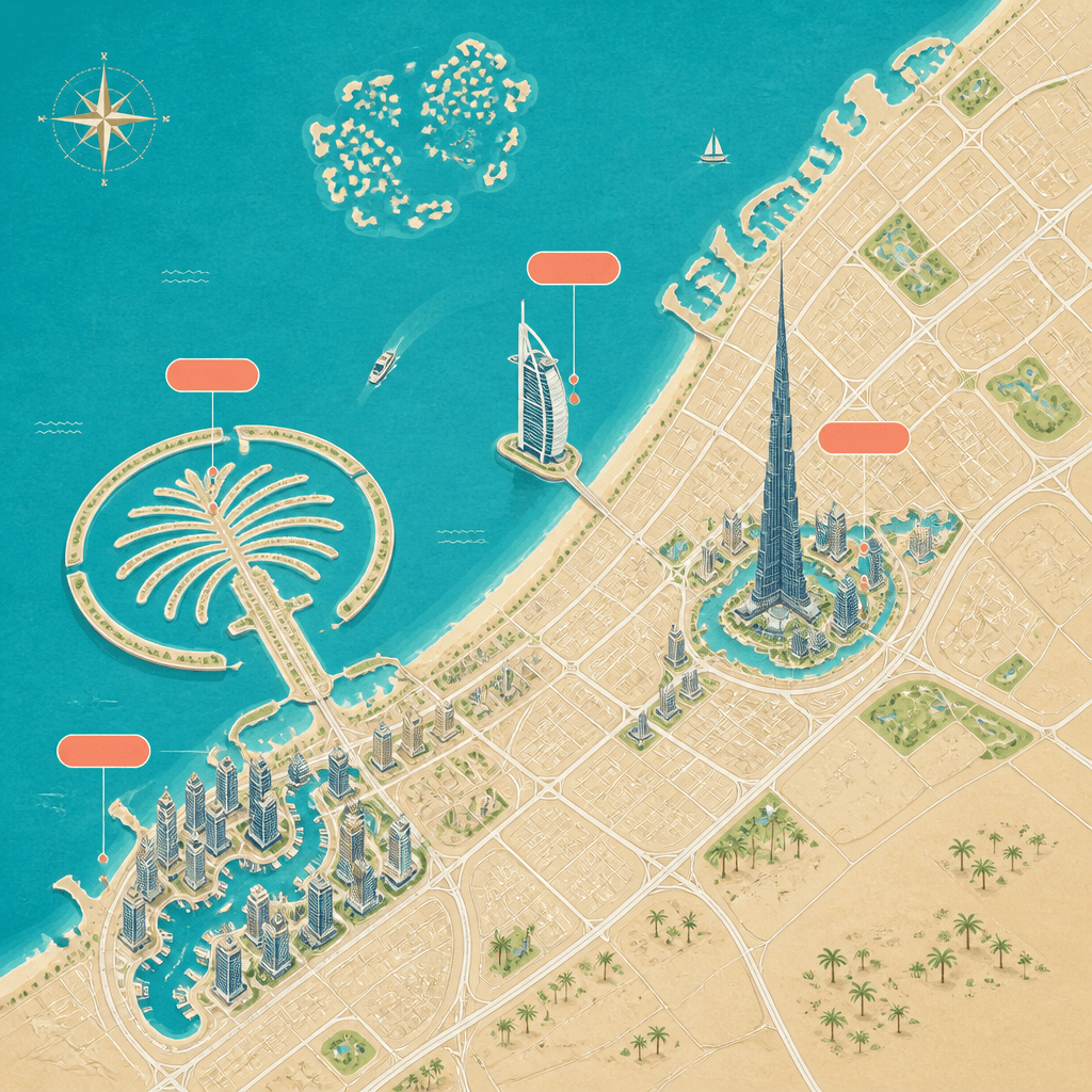
Create a stylized travel map of Dubai with its coastline, roads, and recognizable landmarks.
2026.08.19
Fais « Dubai Map Illustration » exactement comme tu veuxCrée ton propre « Dubai Map Illustration »
Demande-le simplement — Carat génère pour toi des images et des vidéos optimisées.

Commence maintenant avec 100 crédits gratuits par jour
두바이 지도 일러스트
What are Dubai map illustration prompts?
Dubai map illustration prompts create a visual city guide for travel posts, destination cards, tourism posters, and itinerary graphics. Instead of reproducing every street like a navigation system, the prompt simplifies the coastline and road network and uses memorable landmarks as visual anchors. Burj Khalifa, Palm Jumeirah, Burj Al Arab, and Dubai Marina make the city readable even at thumbnail size.
Designing the map
Start with a top-down or slightly isometric view and establish a palette of sand beige land, turquoise water, and coral accents. Describe Palm Jumeirah as a palm-shaped artificial island and Burj Al Arab as a sail-shaped building on a small island. Callout boxes can reserve space for labels, but generated lettering is often unreliable, so blank label zones are useful for later design work.
Where to use it
The image can support a travel blog header, a Dubai itinerary, a tourism event poster, a hotel information card, or an educational city graphic. A square layout fits social cards, while a landscape layout gives the coastline and landmark cluster more room. Treat it as an editorial illustration rather than a navigation map, and verify any factual location information separately.
Writing the prompt
Name the coastline direction, land and sea relationship, landmark list, viewpoint, palette, texture, and information density. Editorial travel illustration, crisp vector-like shapes, and subtle paper grain help the map remain legible. Keep the landmark list short if the result becomes crowded.
Improving the result
Enlarge the four most important landmarks when they appear too small. Add real labels afterward in a design tool. For a consistent city series, lock the viewpoint and palette, then vary the travel theme, season, or decorative elements rather than changing the entire map structure.